
Hydrogen-powered drone system
Drones for long distances: inspection, surveillance and transport from the air
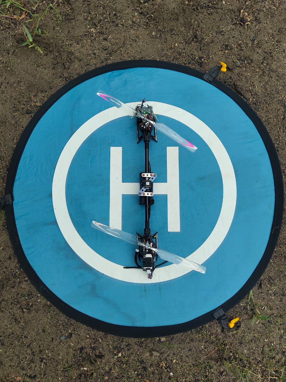
We are a young team developing a complete system of drone and software that can integrate a range of sensors. The tandem rotor and hydrogen fuel cell are designed for long flight times, and the software takes your data from capture straight into your GIS.
The challenge
Inspecting pipelines and railway lines, monitoring large areas, getting goods to hard-to-reach places: today all of this takes a lot of staff, time and money. Many drones are of limited help because their flight time is too short for long distances.
approx. 40,000 km
of gas transmission pipelines in Germany. Their routes must be regularly inspected on foot, by vehicle or from the air.
Sources: FNB Gas, statement 2025 (German); Section 4 GasHDrLtgV (German)
approx. 33,400 km
of railway network operated by DB InfraGO in Germany (operating length 2025).
Source: DB InfraGO, annual report 2025 (German)
55 minutes
maximum flight time of a battery-powered industrial drone (DJI Matrice 350 RTK) according to the manufacturer, measured without payload in still air.
Source: DJI, specifications
Our solution
We combine three building blocks into one system: a tandem rotor drone, a hydrogen fuel cell power system and software with GIS integration. That way you get the flight platform and data processing from one provider, and we integrate the sensors your task needs.
Tandem rotor
Two large rotors instead of many small ones. The design is intended to use significantly less energy in cruise flight than a conventional multicopter, and what it saves is available as reserve for longer missions.
Hydrogen fuel cell
The fuel cell generates power right on board. For the full-scale drone we are targeting flight times of around 2.5 hours, so that long distances can be covered in a single mission.
Software with GIS integration
The software works with a range of sensors and handles the whole workflow, from data capture through processing to export. You can bring the results straight into your GIS environment.
Applications
Infrastructure inspection
Capture long sections of pipelines and railway lines in a single flight, without inspections on foot, helicopter flights or staff on the track.
Transport and logistics
Carry goods over long distances, including to places without roads or where detours cost a lot of time.
City and border surveillance
Keep large areas under observation for long stretches with few take-offs and landings.
Everything from one source
You get drone and software from us as one coordinated system, and we integrate the sensors your task needs. You buy the drone and subscribe to the software in exactly the scope your tasks require. As a small team, we can respond quickly to your requirements.
- Data capture
The drone flies the planned route and records the data you need with the right sensors.
- Processing
The software prepares the raw data and analyses it for your question.
- Export
You export the results in formats your GIS can process directly. That way they feed straight into your existing workflows, such as documentation, maintenance planning or situation maps.
Partners and funders
We are a start-up at Technische Universität Berlin, funded by the Berliner Startup Stipendium (BSS).
This project is funded by the European Union (European Social Fund+) and the State of Berlin.



Let's talk about your mission
Do you have an inspection, surveillance or transport task that takes a lot of effort today? Write to us. We will work out together how Duravia can help, and we are glad to feed your requirements into our development.